7) Incomplete release of radar data and blocking public access to the recorded movement of unidentified targets.
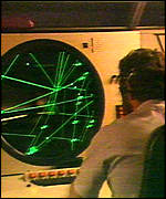
FACT: The NTSB Airplane Performance Study contains radar plots of the immediate vicinity of Flight 800's debris field, showing the paths of various aircraft and surface vessels.[3] The closest surface vessel to Flight 800 when it crashed is shown on one of these plots and was traveling SSE at 30 knots, only 2.9 nautical miles from Flight 800 when it lost electrical power. The sun had set, but this vessel was speeding out to sea. It continued on its original course for at least sixteen minutes. According to the FBI, "the FBI has been unable to identify this vessel."[28]
FACT: Many more targets consistent with surface vessels were recorded on radar further to the south. Most of these targets appeared to be in or en route to the military warning zone W-105, which, according to a Navy spokesperson interviewed by Aerospace Daily, was activated for military use when Flight 800 went down.[29]
FACT: In an attempt to gain more information about the confirmed and unconfirmed surface vessels, FIRO requested more radar data from the NTSB. Through the Freedom of Information Act (FOIA), FIRO requested data from two hours before until two hours after the crash.
FACT: The NTSB initially denied the request and FIRO ultimately filed a law suit for the data in federal court. Before a decision was reached, the NTSB agreed to release the data. Dozens of computer files were sent to FIRO that supposedly contained the data in question. However, much of the data was not included in the release package.
ASSESSMENT: Federal investigators have not determined the identity of the closest ship to Flight 800 when it crashed. Its speed (30 knots) and course (out to sea) are inconsistent with most other surface vessels in the area. The investigative value of determining this vessel's identity within the context of one of the three leading theories for the crash can not be overstated. The NTSB, as the lead agency in charge of determining the cause of the crash, apparently never attempted to determine this or any other surface vessel's identity. Details of an alleged effort by other federal agencies to gain this information were never released. The NTSB is urged to acquire and analyze the details of all alleged investigative efforts by the FBI and any other agency to identify the closest known surface vessel to Flight 800 when it crashed. FIRO is willing to help in this effort and urges the NTSB to release all of the requested radar data.