 | |
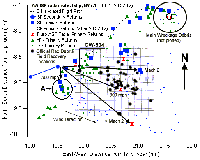
Radar and debris field evidence of wreckage exiting the right side of the aircraft (click to enlarge).
|
FIRO Petition to NTSB: Section IV
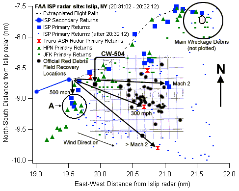
4) Failure to explain or mention multiple high-speed (Mach 2) radar targets near the aircraft at the time of the accident.
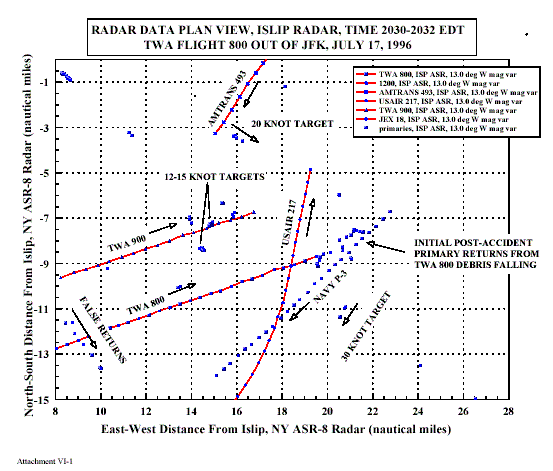
FACT: The McArthur/Islip Airport radar (ISP radar) was the FAA's closest radar site to Flight 800 when it exploded. For approximately 28 minutes up until Flight 800 lost electrical power, only a Navy P-3 Orion aircraft was tracked by the ISP radar in the airspace near where Flight 800 exploded and fell to the sea (see Figure 1).
Complete Petition Section...
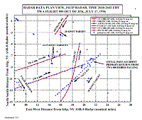
FBI Failed to ID Closest Ship to Flight 800, Refuses to Release ID of Dozens More
When Flight 800 crashed, boats and ships up and down Long Island's coast converged on the crash site. But the four closest didn't react at all.
Two of these four were due west and within six miles of Flight 800 when it exploded. They were on parallel, east-southeast headings, as Flight 800 became a cascade of flames just off the port side of their bows. But strangely, neither changed course or speed during or after the crash.
Complete Article...
 | |
NTSB radar plot containing unidentified surface vessels |
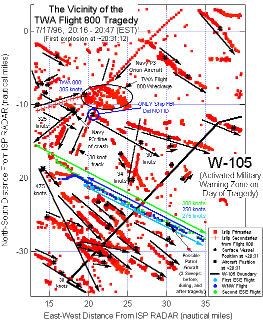
FIRO Petition to NTSB: Section VII
7) Incomplete release of radar data and blocking public access to the recorded movement of unidentified targets.
FACT: The NTSB Airplane Performance Study contains radar plots of the immediate vicinity of Flight 800's debris field, showing the paths of various aircraft and surface vessels.[3] The closest surface vessel to Flight 800 when it crashed is shown on one of these plots and was traveling SSE at 30 knots, only 2.9 nautical miles from Flight 800 when it lost electrical power. The sun had set, but this vessel was speeding out to sea. It continued on its original course for at least sixteen minutes. According to the FBI, "the FBI has been unable to identify this vessel."[28]
Complete Petition Section...
|
